How Integrated GIS Works in a Modern VR/EMS
- WebAdmin
- No Comments
VRS 101: Understanding GIS
There has been a lot of buzz about how geographic information system (GIS) technology improves efficiency and accuracy of address data, but what exactly does it mean?
When GIS technology is a core feature of a voter registration system, it enables several advanced features. All electoral districts, jurisdictions, counties, and other relevant areas are created by the VRS from shapefiles. All addresses in the system, such as voter domiciles and polling places, are geocoded with longitude and latitude data, and validated in real time using an external 3rd party vendor. The geocoded addresses are then spatially mapped to their appropriate districts.
This helps save time while increasing accuracy during both daily administrative work and periodic projects like redistricting. Here are three examples of tasks that become easier with integrated GIS:
Searching for Addresses
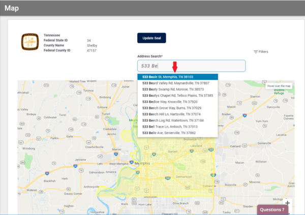
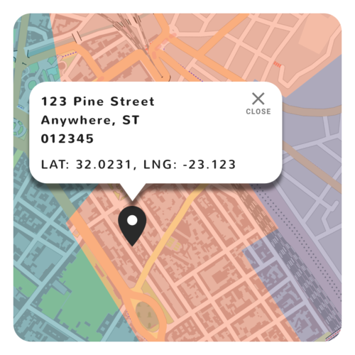
A VRS using GIS offers the advantage of type-ahead features, meaning as you start typing an address, appropriate suggestions pop-up. This allows administrators to auto-complete the address section, saving time and eliminating the chance for typos. Then, when you select an address from the suggested list, a pin is dropped on the map so you can immediately see where the lot/parcel lies with respect to the jurisdiction boundaries. The district and jurisdiction boundaries can be visualized in real time, with different overlays showing various data such as precinct splits, or legislative and congressional districts.
Valuable data such as number of voters in that area can be displayed simply by clicking on a precinct.

Adding New Voters & New Addresses
When adding a new voter, the same auto-populate feature described above searches for existing valid addresses. After the address comes up, a user simply hits “ADD” and the system validates the geocode. From there it will automatically assign the correct voting districts and poll place. Done.
If your voter has a new house in a recently built development with an address not yet able to be validated via USPS, it can be manually geocoded by dropping a pin on the map, and the new voter assignments will populate.
After a manual geocode for a standard address, a notification of the manual action will appear on your dashboard. The vrs will continually query the external address database, and once the address has been added to the USPS system, you will receive a notification to verify and accept it. All notices will be visible until resolved.
The manual geocode process also applies to voters with non-standard addresses, such as a voter experiencing homelessness. Simply add as a new voter, drop a pin to the latitude or longitude of where they stay, and click the box for “alternate domicile non-residential.” No action will be required from there as the location will not be a standard postal service address needing to be validated.
Redistricting

One of the advantages to using GIS is how easy it makes redistricting, which will be very helpful after the 2020 census! Once a geocode is assigned to an address, that point on earth never changes (except through long term tectonic action!). The latitude and longitude stays the same, so as district lines move and shift around them the resident voters’ assignments will change automatically.
Redistricting with a modern VRS is very simple, and compared to the old process of maintaining an accurate street index, may seem like magic! Shapefiles are obtained from a GIS provider such as a State GIS Agency, uploaded, and any changes in district lines results in voters being automatically assigned to new districts. The system will then generate a notification to be sent to the voter with their new assignments.
And it really is that simple- integrated GIS not only makes complex tasks easy, but it reduces human error, saving valuable workday time while improving the integrity of voter data.
Want to learn more about GIS in a VRS? Check out “8 Ways GIS Prevents Districting Distress!“
Share this story, choose your platform!
